
 Search
Traveling Luck for Resenbro Århus, Denmark 
 Explore around
Resenbro?
Explore around
Resenbro? Wikipedia near Resenbro
 Where to stay near Resenbro
The timezone in Resenbro is Europe/Copenhagen
Morning Sunrise at 03:41 and Evening Sunset at 20:57. It's light
Rough GPS position Latitude. 56.1833°, Longitude. 9.6500°
Morning Sunrise at 03:41 and Evening Sunset at 20:57. It's light
Rough GPS position Latitude. 56.1833°, Longitude. 9.6500°
Weather near Resenbro Last report from Karup, 38km away
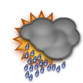 rain Temperature: 14°C / 57°F
Wind: 6.9km/h Northeast
Cloud: Solid Overcast at 3900ft
Satellite map of Resenbro and it's surroudings...
Geographic features & Photographs around Resenbro in Århus, Denmark
populated place a city, town, village, or other agglomeration of buildings where people live and work.
- Resenbro (0km)
- Gødvad (2.2km)
- Skærbæk (2.3km)
- Skellerup Nygårde (2.3km)
- Sminge (3km)
- Skellerup (3km)
- Voel (3.4km)
- Dalsgårde (4km)
- Hårup (4km)
- Mollerup (4km)
- Grauballe (4.2km)
- Svostrup (4.2km)
- Halved (4.6km)
- Sejs (5.3km)
- Linå (5.3km)
- Alderslyst (5.6km)
- Bjørnholt (6km)
- Silkeborg (6km)
- Hattenæs (6km)
- Svejbæk (6.1km)
- Skannerup (7km)
- Holmstol (7.9km)
- Balle Kirkeby (8.1km)
- Nisset (8.2km)
- Dalby (8.8km)
- Sejling (8.8km)
- Sorring (9km)
- Balle By (9km)
- Gjern (9.1km)
lake a large inland body of standing water.
farm a tract of land with associated buildings devoted to agriculture.
- Eriksborg (3km)
- Øster Kejlstrup (4.5km)
- Vester Kejlstrup (5.6km)
- Allingskovgårds Mark (8.4km)
- Thorsminde (8.8km)
forest(s) an area dominated by tree vegetation.
- Nordskoven (3.9km)
- Overholt Plantage (4.9km)
- Østerskov (6.9km)
- Sønderskov (8.4km)
Accommodation around Resenbro

Radisson Blu Papirfabrikken Hotel, Silkeborg Papirfabrikken 12, Silkeborg

Dayz Søhøjlandet Lille Amerika 10, Gjern
HOTEL DANIA SILKEBORG TORVET 5, Silkeborg
hill a rounded elevation of limited extent rising above the surrounding land with local relief of less than 300m.
farms tracts of land with associated buildings devoted to agriculture.
second-order administrative division a subdivision of a first-order administrative division.
- Silkeborg Kommune (3.9km)
- Gjern Kommune (8.1km)
point a tapering piece of land projecting into a body of water, less prominent than a cape.
- Dynæs (8.7km)
populated locality an area similar to a locality but with a small group of dwellings or other buildings.
- Resendal (2.3km)
church a building for public Christian worship.
- Tvilum Kirke (8.1km)
estate(s) a large commercialized agricultural landholding with associated buildings and other facilities.
- Tvilumgård (8.4km)
hills rounded elevations of limited extent rising above the surrounding land with local relief of less than 300m.
- Gjern Bakker (6.9km)
stream a body of running water moving to a lower level in a channel on land.
- Granslev Å (2.3km)
railroad station a facility comprising ticket office, platforms, etc. for loading and unloading train passengers and freight.
- Sminge (4.6km)
 Wikipedia entries close to Resenbro
- Silkeborg city o city
- Gjern city o city
- Låsby city o city
- Them, Denmark city o city
- Hammel city o city
- Skanderborg city i city
- Hinnerup landmark landmark
- Søften city o city
- Brabrand city o city
- Geography of Denmark country country
- Hadsten city o city
- Gedved city o city
- Viborg city h city
- Skejby city o city
- Den Gamle By museum landmark
- Århus City Hall building landmark
Airports close to Resenbro
Karup(KRP), Karup, Denmark (38km)Billund(BLL), Billund, Denmark (63.4km)
Aarhus(AAR), Aarhus, Denmark (66.9km)
Stauning(STA), Stauning, Denmark (90.7km)
Odense(ODE), Odense, Denmark (97.4km)
Airfields or small strips close to Resenbro
Skive, Skive, Denmark (54.6km)Vandel, Vandel, Denmark (66.5km)
Aars, Vesthimmerland, Denmark (81.1km)
Lindtorp, Lindtorp, Denmark (85.1km)
Kolding vamdrup, Kolding, Denmark (93.1km)