
 Search
Traveling Luck for Sankt Thomas Kärnten, Austria 
 Explore around
Sankt Thomas?
Explore around
Sankt Thomas? Wikipedia near Sankt Thomas
 Where to stay near Sankt Thomas
The timezone in Sankt Thomas is Europe/Vienna
Morning Sunrise at 04:09 and Evening Sunset at 19:47. It's light
Rough GPS position Latitude. 46.8167°, Longitude. 14.8167°
Morning Sunrise at 04:09 and Evening Sunset at 19:47. It's light
Rough GPS position Latitude. 46.8167°, Longitude. 14.8167°
Weather near Sankt Thomas Last report from Klagenfurt-Flughafen, 47.5km away
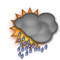 rain Temperature: 13°C / 55°F
Wind: 2.3km/h
Cloud: Few at 600ft Scattered at 1200ft Broken at 3600ft
Satellite map of Sankt Thomas and it's surroudings...
Geographic features & Photographs around Sankt Thomas in Kärnten, Austria
populated place a city, town, village, or other agglomeration of buildings where people live and work.
- Sankt Thomas (0km)
- Reinfelsdorf (0km)
- Sankt Marein (0.9km)
- Kleinedling (1km)
- Völking (2.1km)
- Altendorf (2.1km)
- Sankt Jakob (2.6km)
- Hattendorf (2.6km)
- Sankt Michael (2.7km)
- Eselsdorf (2.8km)
- Reding (2.9km)
- Oberaigen (3.1km)
- Sankt Stefan (3.3km)
- Winkling (3.6km)
- Kleinwinklern (3.6km)
- Pollheim (3.6km)
- Großedling (3.6km)
- Maildorf (3.6km)
- Thürn (3.6km)
- Siegelsdorf (3.6km)
- Fischering (3.9km)
- Wolfsberg (3.9km)
- Pfaffendorf (4.3km)
- Kleinrojach (4.3km)
- Fischering (4.3km)
- Sankt Johann (4.4km)
- Paildorf (4.4km)
- Sankt Margarethen im Lavanttal (4.5km)
- Unteraigen (4.5km)
- Wolkersdorf (5.2km)
- Kollegg (5.2km)
- Wölzing (5.5km)
- Hintergumitsch (6.1km)
- Frantschach (6.1km)
- Schönweg (6.1km)
- Kienberg (6.1km)
- Vordergumitsch (6.2km)
- Lading (6.2km)
- Michaelsdorf (6.2km)
- Reideben (6.2km)
- Reisberg (6.2km)
- Sankt Andrä (6.5km)
- Riegelsdorf (6.5km)
- Unterleidenberg (6.6km)
- Unteragsdorf (6.6km)
- Oberagsdorf (6.6km)
- Vorderwölch (7km)
- Zellach (7km)
- Siebending (7km)
- Magersdorf (7km)
- Pölling (7.2km)
stream a body of running water moving to a lower level in a channel on land.
- Reisberger Bach (1.8km)
- Arlingbach (2.6km)
- Hattendorfer Bach (2.9km)
- Weißenbach (3.4km)
- Auen Bach (4.6km)
- Wois Bach (6.1km)
farm a tract of land with associated buildings devoted to agriculture.
- Neudau (2.6km)
valley an elongated depression usually traversed by a stream.
- Unteres Lavanttal (3.6km)
Accommodation around Sankt Thomas

Alpengasthof Wolfgruber Rieding 11, Koralpe, Wolfsberg

Moselebauer Kliening 30, Bad Sankt Leonhard im Lavanttal

Hotel Bärnthaler Gasthof Restaurant Obdacher Bundesstrasse 290a, Bad Sankt Leonhard im Lavanttal
administrative division an administrative division of a country, undifferentiated as to administrative level.
- Politischer Bezirk Wolfsberg (2.6km)
railroad station a facility comprising ticket office, platforms, etc. for loading and unloading train passengers and freight.
 Wikipedia entries close to Sankt Thomas
- Wolfsberg (Kärnten) city h city
- Schloss Wolfsberg (Kärnten) manor-house landmark
- Sankt Andrä (Kärnten) city i city
- Frantschach-Sankt Gertraud city l city
- Koralpe mountain g mountain
- Sankt Paul im Lavanttal city l city
- Sankt Georgen im Lavanttal city m city
- Stift St. Paul im Lavanttal monastery landmark
- Griffen city l city
- Saualpe mountain g mountain
- Preitenegg city m city
- Weinebene mountain h mountain
- Bad Sankt Leonhard im Lavanttal city l city
- Diex city n city
- Klippitztörl mountain h mountain
- Sankt Oswald ob Hornburg city n city
Airports close to Sankt Thomas
Klagenfurt(aus-afb)(KLU), Klagenfurt, Austria (47.5km)Graz mil/civ(GRZ), Graz, Austria (58.8km)
Ljubljana(LJU), Ljubliana, Slovenia (82.3km)
Maribor(MBX), Maribor, Slovenia (87.9km)
Ronchi dei legionari(TRS), Ronchi de legionari, Italy (174.5km)
Airfields or small strips close to Sankt Thomas
Klagenfurt, Klagenfurt, Austria (47.6km)Zeltweg, Zeltweg, Austria (49.7km)
Slovenj gradec, Slovenj gradec, Slovenia (51.4km)
Graz, Graz, Austria (58.9km)
Cerklje, Cerklje, Slovenia (133.5km)