
 Search
Traveling Luck for Aspengo general, Guam 
 Explore around
Aspengo?
Explore around
Aspengo? Wikipedia near Aspengo
 Where to stay near Aspengo
The timezone in Aspengo is Pacific/Guam
Morning Sunrise at 05:52 and Evening Sunset at 18:46. It's Dark
Rough GPS position Latitude. 13.4617°, Longitude. 144.7944° , Elevation. 64m
Morning Sunrise at 05:52 and Evening Sunset at 18:46. It's Dark
Rough GPS position Latitude. 13.4617°, Longitude. 144.7944° , Elevation. 64m
Weather near Aspengo Last report from Agana, Guam International Airport, GU 4km away
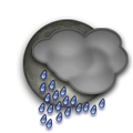 heavy rain mist Temperature: 26°C / 79°F
Wind: 11.5km/h East
Cloud: Scattered at 1700ft Scattered at 2900ft Broken at 3900ft
Satellite map of Aspengo and it's surroudings...
Geographic features & Photographs around Aspengo in general, Guam
populated place a city, town, village, or other agglomeration of buildings where people live and work.
Local Feature A Nearby feature worthy of being marked on a map..
- San Vicente Ferrer-San Roke Church (1.2km)
- San Ramon Chapel (1.4km)
- Full Gospel Korean Church (2.4km)
- Hagåtña Detention Facility (2.4km)
- Harvest Baptist Church (2.5km)
- Immaculate Heart of Mary Church (2.7km)
- Guam Adult Correctional Facility (2.9km)
- Santa Teresita Church (3km)
- United States Naval Air Station Agana (historical) (4km)
- Admiral Nimitz Golf Course (4.6km)
- Hafa Adai Exchange Shopping Center (4.8km)
- Camp Quezon (historical) (4.8km)
- Barrigada Pumping Station (5km)
school building(s) where instruction in one or more branches of knowledge takes place.
- L P Untalan Middle School (0.9km)
- Luis P Untalan Middle School (0.9km)
- San Vicente School (1km)
- B P Carbullido Elementary School (1.5km)
- Pedro C Lujan Elementary School (2.3km)
- Harvest Christian Academy (2.5km)
- H B Price Elementary School (2.5km)
- Henry B Price Elementary School (2.6km)
- Juan Q San Miguel Elementary School (4km)
- Father Duenas Memorial High School (4.5km)
- Guam Community College (4.5km)
- George Washington High School (4.7km)
area a tract of land without homogeneous character or boundaries.
- Mafnas Nete (1km)
- Sabana Maagas (3.1km)
- Chochogo (3.5km)
- Eda Agage (3.8km)
- Tai (4.1km)
- Conga (4.3km)
- Mapas (4.3km)
- Maimai (4.3km)
- Pedonlisong (4.8km)
- Ngachang (4.9km)
- Fadian (5km)
Accommodation around Aspengo

Palmridge Inn 122 Hasalao Street Route 8, Barrigada

Tamuning Plaza Hotel 960 South Marine Drive, Tamuning

Alupang Beach Tower 999 South Marine Drive, Tamuning
park an area, often of forested land, maintained as a place of beauty, or for recreation.
- Barrigada War Memorial Park (1.1km)
- Admiral William E Leahy Sports Complex (2.6km)
- Tun Ignacio C Cepeda Ballpark (2.8km)
- Mangilao Mayors Baseball Field (2.8km)
- Old Mangilao Baseball Field (2.9km)
administrative division an administrative division of a country, undifferentiated as to administrative level.
- Barrigada Election District (2.6km)
- Mongmong-Toto-Maite Election District (4.3km)
building(s) a structure built for permanent use, as a house, factory, etc..
- Guam Air Terminal (4.8km)
hospital a building in which sick or injured, especially those confined to bed, are medically treated.
- Central Public Health Center (4.2km)
airport a place where aircraft regularly land and take off, with runways, navigational aids, and major facilities for the commercial handling of passengers and cargo.
- Guam International Airport (3.8km)
 Wikipedia entries close to Aspengo
- Antonio B. Won Pat International Airport airport airport
- Geography of Guam
- Hagåtña city o city
- Guam isle isle
- Apra Harbor
- Andersen Air Force Base airport airport
- Rota International Airport airport airport
Airports close to Aspengo
Guam international(GUM), Agana, Mariana islands (4km)Andersen afb(UAM), Andersen, Mariana islands (32.1km)
Rota international(ROP), Rota, Mariana islands (148.3km)