
 Search
Traveling Luck for Lamotte Guadeloupe (general), Guadeloupe 
 Explore around
Lamotte?
Explore around
Lamotte? Wikipedia near Lamotte
 Where to stay near Lamotte
The timezone in Lamotte is America/Guadeloupe
Morning Sunrise at 05:32 and Evening Sunset at 18:36. It's light
Rough GPS position Latitude. 16.2500°, Longitude. -61.4000°
Morning Sunrise at 05:32 and Evening Sunset at 18:36. It's light
Rough GPS position Latitude. 16.2500°, Longitude. -61.4000°
Weather near Lamotte Last report from Le Raizet, Guadeloupe, 22km away
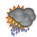 heavy rain fog Temperature: 25°C / 77°F
Wind: 12.7km/h South
Cloud: Few at 1100ft Broken at 2100ft Broken at 3300ft
Satellite map of Lamotte and it's surroudings...
Geographic features & Photographs around Lamotte in Guadeloupe (general), Guadeloupe
populated place a city, town, village, or other agglomeration of buildings where people live and work.
- Lamotte (0km)
- D' Équainville (2.8km)
- Deshauteurs (2.8km)
- Grands Fonds (4km)
- Plaisance (4km)
- Douville (5.5km)
- Seforge (6.2km)
- Boivin (6.2km)
- Belle Place (6.2km)
- Sainte-Anne (6.2km)
- Mare Gaillard (8km)
- Châteaubrun (8.3km)
- Bérard (8.3km)
- Port Blanc (8.8km)
- Château-Gaillard (9km)
- Richeplaine (11.4km)
- Boisvin (11.4km)
- Cocoyer (11.4km)
- Blanchet (11.4km)
- Fontaine (11.4km)
- Clugny (11.4km)
- Fonds d' Or (11.9km)
populated locality an area similar to a locality but with a small group of dwellings or other buildings.
cove(s) a small coastal indentation, smaller than a bay.
- Anse Bourdelle (5.7km)
- Anse à Saint (5.7km)
- Anse à Coudroy (5.7km)
- Anse du Belley (6.2km)
- Anse de Sainte-Anne (6.4km)
- Anse à Eblain (6.4km)
- Trou à Coa (8.8km)
- Anse à Jacques (9km)
- Petit Havre (9km)
- Gros Sable (11.4km)
point a tapering piece of land projecting into a body of water, less prominent than a cape.
- Pointe à Meise (5.7km)
- Pointe de Sainte-Anne (6.4km)
- Pointe de l' Accul (6.4km)
- Pointe Roseau (6.4km)
- Pointe Pierre (6.4km)
- Pointe de l' Anse Rouge (9km)
- Pointe du Petit Havre (10.2km)
- Pointe de la Saline (10.2km)
Accommodation around Lamotte

hôtel Mahogany Pointe de la verdure bp 61, Gosier

Hotel le Diwali Plage De Sainte Anne, Ste Anne

LA CREOLE BEACH HOTEL SPA Pointe de la Verdure, GOSIER
channel the deepest part of a stream, bay, lagoon, or strait, through which the main current flows.
- Petite Passe (5.7km)
- Grande Passe (6.4km)
rock a conspicuous, isolated rocky mass.
- Le Citronnier (8.8km)
- Le Diamant (10.2km)
lake a large inland body of standing water.
- Étang Cocoyer (10.2km)
- Mare de l' Écluse (10.2km)
beach a shore zone of coarse unconsolidated sediment that extends from the low-water line to the highest reach of storm waves.
- Plage de Bois Jolan (8.8km)
hill a rounded elevation of limited extent rising above the surrounding land with local relief of less than 300m.
- Bombo (5.5km)
hills rounded elevations of limited extent rising above the surrounding land with local relief of less than 300m.
- Les Grands Fonds (6.2km)
 Wikipedia entries close to Lamotte
- Grande-Terre isle isle
- Pointe-à-Pitre International Airport airport airport
- Geography of Guadeloupe country country
- Guadeloupe isle isle
- Îles de la Petite Terre isle isle
- La Désirade isle isle
- Soufrière (Guadeloupe) mountain h mountain
- Marie-Galante isle isle
- Basse-Terre (Stadt) city i city
- Îles des Saintes isle isle
- Guadeloupe Passage
- Dominica Passage
- Barroui
- Vieille Case
- Hampstead, Dominica
- Paix Bouche
Airports close to Lamotte
Le raizet(PTP), Pointe-a-pitre, Antilles (22km)Melville hall(DOM), Dominica, Dominica (122.3km)
Canefield(DCF), Canefield, Dominica (157.7km)
V c bird international(ANU), Antigua, Leeward islands (164.5km)