Traveling Luck for Hirooka-Gōbara Nagano, Japan 
Alternatively known as Gobara, Gohara, Gōbara, Gōhara
The timezone in Hirooka-Gobara is Asia/Tokyo
Morning Sunrise at 04:32 and Evening Sunset at 19:00. It's light
Rough GPS position Latitude. 36.1333°, Longitude. 137.9333°
Morning Sunrise at 04:32 and Evening Sunset at 19:00. It's light
Rough GPS position Latitude. 36.1333°, Longitude. 137.9333°
Weather near Hirooka-Gōbara Last report from Matsumoto Airport, 4.8km away
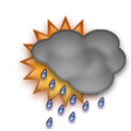
 light shower(s) rain mist Temperature: 14°C / 57°F
Wind: 3.5km/h West/Northwest
Cloud: Few at 1000ft Broken at 2000ft Broken at 3500ft
Satellite map of Hirooka-Gōbara and it's surroudings...
Geographic features & Photographs around Hirooka-Gōbara in Nagano, Japan
populated place a city, town, village, or other agglomeration of buildings where people live and work.
- Hirooka-Gōbara (0km)
- Nakamura (3km)
- Muraimachi (6km)
- Daimon (6km)
- Shiojiri (6km)
- Seba (7.2km)
- Shimo-ōike (8.8km)
- Wadamachi (9.4km)
- Shimo-hata (11.7km)
- Naka-hata (11.7km)
- Shimo-nii (11.7km)
- Sasabe (11.7km)
- Kami-nii (12.1km)
- Kita-ono (12.2km)
- Minami-ōzuma (12.8km)
- Tsukama (12.8km)
- Komiya (14km)
- Matsumoto (14.4km)
- Ono (14.4km)
- Kita-ōzuma (15km)
- Azusabashi (16.3km)
- Akamatsu (16.5km)
- Hitoichiba (16.6km)
- Okaya (17.5km)
- Hanaoka (17.5km)
- Shimajima (18.2km)
- Ryūshima (18.2km)
- Toyobashi (18.9km)
- Shimo-suwa (19.3km)
- Asama (19.3km)
fourth-order administrative division a subdivision of a third-order administrative division.
- Hirooka-mura (3km)
- Shiojiri-machi (6km)
- Kataoka-mura (6.1km)
- Sōga-mura (9.4km)
- Chikumaji-mura (10km)
- Ono-mura (14.4km)
- Shinano (20km)
- Kawashima-mura (20.9km)
administrative division an administrative division of a country, undifferentiated as to administrative level.
- Hata-machi (11.7km)
- Nii-mura (12.1km)
- Shimauchi-mura (16.2km)
- Hotaka-machi (17.5km)
- Azasagawa-mura (17.8km)
- Tōsan-chihō (20km)
second-order administrative division a subdivision of a first-order administrative division.
- Shiojiri-shi (6.9km)
- Matsumoto-shi (14.4km)
- Okaya-shi (15.7km)
- Higashi-chikuma-gun (16.3km)
Accommodation around Hirooka-Gōbara
Hotel Route-Inn Shiojiri 1548-1 Hirookatakaide, Oh-aza, Shiojiri
Hotel Route-Inn Shiojirikita Inter 842-1, Hirooka Yoshida, Oh-aza, Shiojiri
Chisun Inn Shiojiri Kita Ic 642-3 Hirookayoshida, Oaza, Shiojiri
stream a body of running water moving to a lower level in a channel on land.
- Kusari-gawa (9.2km)
- Narai-gawa (18.6km)
- Azusa-gawa (20.9km)
mountain an elevation standing high above the surrounding area with small summit area, steep slopes and local relief of 300m or more.
- Hachibuse-yama (15.7km)
- Yuzawa-yama (21.2km)
section of populated place a neighborhood or part of a larger town or city.
- Koyanagichō (14.4km)
- Oguchi (16.1km)
valley an elongated depression usually traversed by a stream.
- Matsumoto-daira (16.3km)
island a tract of land, smaller than a continent, surrounded by water at high water.
- Honshū (20km)
independent political entity An independent state.
- Japan (20km)
airport a place where aircraft regularly land and take off, with runways, navigational aids, and major facilities for the commercial handling of passengers and cargo.
- Matsumoto Airport (4.6km)
first-order administrative division a primary administrative division of a country, such as a state in the United States.
- Nagano-ken (20km)
 Wikipedia entries close to Hirooka-Gōbara
- Matsumoto city e city
- Matsumoto-jō castle landmark
- Oguchi, Aichi city o city
- Okaya, Nagano city o city
- Suwa-Taisha landmark landmark
- Suwa-See lake waterbody
- Toyoshina, Nagano city o city
- Suwa, Nagano city o city
- Präfektur Nagano adm1st adm1st
- Hotaka, Nagano city o city
- Akashina, Nagano city o city
- Aida, Okayama city o city
- Chino, Nagano city o city
- Ina, Nagano city o
- Maruko, Nagano city o city
- Ueda, Nagano (new city) city o city
Airports close to Hirooka-Gōbara
Matsumoto(MMJ), Matsumoto, Japan (4.8km)Toyama(TOY), Toyama, Japan (109.8km)
Nagoya(NGO), Nagoya, Japan (167.6km)
Yokota ab(OKO), Yokota, Japan (168.6km)
Komatsu(KMQ), Kanazawa, Japan (174.9km)
Airfields or small strips close to Hirooka-Gōbara
Gifu, Gifu, Japan (158.5km)Iruma, Iruma, Japan (171.5km)
Kastner aaf, Zama, Japan (186.5km)
Shizuhama, Yaizu, Japan (188.9km)
Chofu, Tokyo, Japan (191.4km)

 Search
 Explore around
Hirooka-Gobara?
 Wikipedia near Hirooka-Gobara
 Where to stay near Hirooka-Gōbara

