
 Search
Traveling Luck for Futoo Hyōgo, Japan 
Alternatively known as Toyotomi
 Explore around
Futoo?
Explore around
Futoo? Wikipedia near Futoo
 Where to stay near Futoo
The timezone in Futoo is Asia/Tokyo
Morning Sunrise at 04:56 and Evening Sunset at 18:59. It's light
Rough GPS position Latitude. 34.9000°, Longitude. 134.7500°
Morning Sunrise at 04:56 and Evening Sunset at 18:59. It's light
Rough GPS position Latitude. 34.9000°, Longitude. 134.7500°
Weather near Futoo Last report from KOBE, null 67.3km away
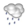 drizzle dust Temperature: 19°C / 66°F
Wind: 40.3km/h West
Cloud: Few at 2500ft Scattered at 7000ft
Satellite map of Futoo and it's surroudings...
Geographic features & Photographs around Futoo in Hyōgo, Japan
populated place a city, town, village, or other agglomeration of buildings where people live and work.
- Futoo (0km)
- Nibuno (6.1km)
- Tsujikawa (7.3km)
- Miyaoki (9.9km)
- Hōjō (10.7km)
- Maenoshō (12.1km)
- Himeji (13km)
- Shikata (14km)
- Bessho (14km)
- Chōda (14.3km)
- Yaka (16.5km)
- Ōshio (16.5km)
- Shirahama (16.8km)
- Mega (17.4km)
- Kiba (18.8km)
- Ihozaki (19.1km)
- Hayashida (19.3km)
- Takaoka (19.4km)
- Arai (19.6km)
- Ōta (19.7km)
- Ao (19.8km)
- Temma (20.8km)
- Anji (20.9km)
- Fukumoto (21.1km)
- Myōrakuji (21.4km)
- Ikaruga (21.4km)
- Takasago (21.8km)
- Kakogawa (22km)
fourth-order administrative division a subdivision of a third-order administrative division.
- Hanada-mura (10.1km)
- Amida-mura (14.5km)
- Ise-mura (15.6km)
- Sone-chō (16.5km)
- Harima (17km)
- Hayashida-chō (17.3km)
- Tatsuta-mura (18.7km)
- Hayashida-mura (19.3km)
- Iho-mura (19.6km)
- Ōta-mura (19.7km)
- Kamioka-mura (21.3km)
- Ikaruga-chō (21.4km)
- Arai-mura (21.8km)
area a tract of land without homogeneous character or boundaries.
- Toyotomi (2.3km)
- Nishi-tawara (7.3km)
- Shikama-ku (17km)
- Hirohata-ku (19.5km)
stream a body of running water moving to a lower level in a channel on land.
- Semba-gawa (19km)
- Yaka-gawa (19.1km)
- Ichi-kawa (20.2km)
- Yumesaki-gawa (21.2km)
Accommodation around Futoo
Yumenoi 187 Maenosho, Himeji

Hotel Wing International Himeji 132 Wata-machi, Himeji

Comfort Hotel Himeji 1-50-3 Hojo-guchi, Himeji
second-order administrative division a subdivision of a first-order administrative division.
- Himeji-shi (13.4km)
- Innami-gun (15.1km)
- Takasago-shi (16.8km)
administrative division an administrative division of a country, undifferentiated as to administrative level.
- Tawara-mura (7.3km)
- Fukuzaki-chō (9.5km)
third-order administrative division a subdivision of a second-order administrative division.
- Yoneda-chō (18.1km)
- Yagi-mura (19.1km)
section of populated place a neighborhood or part of a larger town or city.
- Miya (17km)
- Takahamachō (19.5km)
harbor(s) a haven or space of deep water so sheltered by the adjacent land as to afford a safe anchorage for ships.
- Shikama-kō (19km)
- Iho-kō (21.1km)
mountain an elevation standing high above the surrounding area with small summit area, steep slopes and local relief of 300m or more.
- Nagusa-yama (15.2km)
 Wikipedia entries close to Futoo
- Himeji-jō world herita landmark
- Kasai, Hyōgo city o city
- Himeji city c city
- Ikaruga, Nara city o city
- Takasago city e city
- Kakogawa city d city
- Ono, Hyogo city o city
- Präfektur Hyōgo adm1st adm1st
- Kibi, Wakayama city o city
- Tatsuno, Hyogo city o city
- Nishiwaki, Hyogo city o city
- Miki, Hyogo city o city
- Shiso, Hyogo city o city
- Aioi, Hyogo city o city
- Mikazuki, Hyogo city o city
- Ikuno, Hyogo city o city
Airports close to Futoo
Osaka international(ITM), Osaka, Japan (81.2km)Okayama(OKJ), Okayama, Japan (105.4km)
Tokushima(TKS), Tokushima, Japan (109.2km)
Tottori(TTJ), Tottori, Japan (110.6km)
Takamatsu(TAK), Takamatsu, Japan (128.9km)
Airfields or small strips close to Futoo
Kohnan, Kohnan, Japan (104.1km)Yao, Osaka, Japan (107.6km)